Import a GPX file

Area B (Halfmoon Bay) trails

Click on a trail to view its statistics, map and profile.
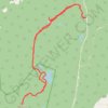
Hike up Mount Richardson

Canada > British Columbia > Sunshine Coast Regional District > Area B (Halfmoon Bay)

Hike

Distance: 15.4 Km • Elevation gain: 597 m • Maximum elevation: 974 m
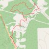
Homesite Creek Loop Walk

Canada > British Columbia > Sunshine Coast Regional District > Area B (Halfmoon Bay) > Halfmoon Bay

Distance: 6.6 Km • Elevation gain: 160 m • Maximum elevation: 175 m

Other places

Gear up for your next adventure:

🎒Tactical Waist Packs - Quick access to your compass, phone, and snacks while walking
💧Personal Water Filters - Drink safely from streams and lakes identified on your map
🧊Insulated Stainless Steel Flasks - Keep water cold for 24 hours in the heat or coffee hot in the cold
🥤Hydration Packs - Hydration systems for hiking
📡Portable Emergency Radios - Stay informed about weather warnings and bushfire alerts

As an Amazon Associate, this site earns from qualifying purchases at no extra cost to you.