Import a GPX file

Dent trails

Click on a trail to view its statistics, map and profile.
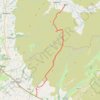
Hike from Dent to Masongill via Crag Hill, Great Coum, Green Hill and Gragareth

United Kingdom > England > Westmorland and Furness > Dent

Distance: 17.4 Km • Elevation gain: 602 m • Maximum elevation: 687 m

Gear up for your next adventure:

🧴SPF 50+ Bulk Sunscreen - Maximum protection for long-term outdoor exposure
🩹Blister Prevention Tape - Apply to friction points before they become painful sores
🦟Insect Repellent - Protection against insects
🧣Merino Neck Gaiters - Versatile headwear for warmth, sun protection, or dust filtering
🧥Packable Rain Jackets - Breathable waterproof layers for unpredictable mountain weather

As an Amazon Associate, this site earns from qualifying purchases at no extra cost to you.