Import a GPX file

Caryville trails

Click on a trail to view its statistics, map and profile.
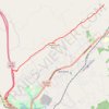
Cumberland Trail (CT) - Bruce Gap to Cumberland Mountain - Eagle Bluff

United States > Tennessee > Campbell County > Caryville

Distance: 14.3 Km • Elevation gain: 585 m • Maximum elevation: 645 m

Gear up for your next adventure:

🧰Survival Kits - Essential survival gear
🎨Portable Watercolor Kits - Paint the landscapes and topographic views you discover
👖Convertible Hiking Trousers - Zip-off legs to adapt to changing temperatures throughout the day
🥾Trail Running Shoes - Shoes for trail running
🧥Thermal Emergency Blankets - Compact Mylar blankets to prevent hypothermia if stranded overnight

As an Amazon Associate, this site earns from qualifying purchases at no extra cost to you.