Import a GPX file

Luk Wu trails

Click on a trail to view its statistics, map and profile.
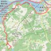
獅子頭南坑左 獅子頭坑 昂深下源 深石坑

China > Hong Kong > Islands District > Luk Wu

Islands District Hike

Distance: 15.3 Km • Elevation gain: 590 m • Maximum elevation: 311 m
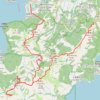
深坑瀝小路

China > Hong Kong > Islands District > Luk Wu

Distance: 16.6 Km • Elevation gain: 726 m • Maximum elevation: 462 m
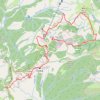
獅子頭山 蓮花台麒麟石 大鐵鎚石 昂坪

China > Hong Kong > Islands District > Luk Wu

Distance: 8.0 Km • Elevation gain: 528 m • Maximum elevation: 679 m

Gear up for your next adventure:

Outdoor Coffee Makers - Enjoy quality coffee at the summit of your favorite peak
🧤Hiking Gloves - Protective gloves for outdoor use
👣Snake & Scrub Gaiters - Protection against spinifex, mud, and snakes while walking off-track
🗺️Topographic Maps - Detailed maps for hiking and navigation
📚Map Reading & Navigation Guides - Master the art of interpreting topographic contours and symbols

As an Amazon Associate, this site earns from qualifying purchases at no extra cost to you.