Import a GPX file

Grebenac trails

Click on a trail to view its statistics, map and profile.
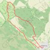
Grebenac - Zagajička brda

Serbia > Vojvodina > South Banat Administrative District > Bela Crkva Municipality > Grebenac

Distance: 14.7 Km • Elevation gain: 259 m • Maximum elevation: 243 m
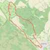
Zagajička Brda - Deliblatska peščara

Serbia > Vojvodina > South Banat Administrative District > Bela Crkva Municipality > Grebenac

Distance: 15.0 Km • Elevation gain: 250 m • Maximum elevation: 243 m

Gear up for your next adventure:

🛰️Handheld GPS Units - Rugged GPS devices for tracking coordinates and elevation in the Australian bush
🧥Softshell Jackets - Flexible outdoor jackets
🧭Global Orienteering Compass - High-precision liquid-filled compasses for accurate map reading and navigation
🪢550 Survival Paracord - Versatile cordage for gear repair and emergency lashing
🔋Solar Power Banks - Charge your phone and GPS using the sun while deep in the bush

As an Amazon Associate, this site earns from qualifying purchases at no extra cost to you.