Import a GPX file

Knodishall trails

Click on a trail to view its statistics, map and profile.
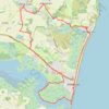
Suffolk Coast Path: Thorpeness to Aldeburgh

United Kingdom > England > Suffolk > East Suffolk > Knodishall

Distance: 21.8 Km • Elevation gain: 116 m • Maximum elevation: 24 m

Gear up for your next adventure:

📷Backpack Camera Clips - Quick access to your camera while keeping your hands free for climbing
🧺Waterproof Dry Sacks - Organize your pack and keep electronics safe from rain and river crossings
🎒Dry Bags - Waterproof bags for outdoor gear
🧥Packable Rain Jackets - Breathable waterproof layers for unpredictable mountain weather
🦟Insect Repellent - Protection against insects

As an Amazon Associate, this site earns from qualifying purchases at no extra cost to you.