Import a GPX file

North Grapetree Bay trails

Click on a trail to view its statistics, map and profile.
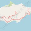
Trail near Point Udal connecting to GrapeTree

United States > United States Virgin Islands > Saint Croix District > North Grapetree Bay

Distance: 10.4 Km • Elevation gain: 385 m • Maximum elevation: 185 m

Gear up for your next adventure:

🔋Solar Power Banks - Solar chargers for outdoors
🌧️Rain Jackets - Waterproof jackets for hiking
🥾Heavy Duty Hiking Boots - Ankle-supporting boots for carrying heavy packs on steep contours
🎒3L Hydration Reservoirs - Hands-free drinking to stay hydrated on steep contour climbs
📕Australia Maps - Maps covering Australian regions

As an Amazon Associate, this site earns from qualifying purchases at no extra cost to you.