
Area C (Butedale/Kitlope/Kitsumkalum) trails
Click on a trail to view its statistics, map and profile.
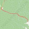
Hike up Gunsight Lake Trail
Canada > British Columbia > Regional District of Kitimat-Stikine > Area C (Butedale/Kitlope/Kitsumkalum)
Distance: 14.6 Km • Elevation gain: 1,037 m • Maximum elevation: 1,100 m

Sleeping Beauty Mountain Provincial Park
Canada > British Columbia > Regional District of Kitimat-Stikine > Area C (Butedale/Kitlope/Kitsumkalum)
#Hiking #MTB #SleepingBeautyMountain
Distance: 8.1 Km • Elevation gain: 610 m • Maximum elevation: 1,143 m