
Nelson trails
Click on a trail to view its statistics, map and profile.
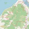
Horoirangi / Drumduan Loop via Cable Bay Walkway and Overlook
New Zealand > Nelson > Nelson > Hira
Distance: 25.7 Km • Elevation gain: 1,488 m • Maximum elevation: 408 m

Loop around Centre of NZ, Maitai Valley, Branford Park
New Zealand > Nelson > Nelson
Distance: 8.4 Km • Elevation gain: 274 m • Maximum elevation: 168 m

Maungatapu - Saddle Hill loop
New Zealand > Nelson > Nelson
Distance: 17.8 Km • Elevation gain: 1,330 m • Maximum elevation: 1,162 m

Nelson, Maitai Valley
New Zealand > Nelson > Nelson
Distance: 17.5 Km • Elevation gain: 468 m • Maximum elevation: 169 m