Import a GPX file

Sleepy Hollow Manor trails

Click on a trail to view its statistics, map and profile.
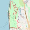
Rockwood Hall Loop

United States > New York > Westchester County > Town of Mount Pleasant > Sleepy Hollow Manor

Distance: 5.4 Km • Elevation gain: 101 m • Maximum elevation: 56 m

Gear up for your next adventure:

📣High-Decibel Survival Whistles - Signaling tool for rescue that carries much further than a human voice
⌚Altimeter Watches - Watches with altitude tracking
🚁Camera Drones with GPS - Capture aerial views of the landscape to compare with topo maps
📸Action Cameras - Record your journey across interesting topographic features in 4K
🧭Military Style Lensatic Compass - Durable sighting compasses for advanced land navigation and surveying

As an Amazon Associate, this site earns from qualifying purchases at no extra cost to you.