Import a GPX file

Town of Richmond trails

Click on a trail to view its statistics, map and profile.
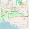
Sandy Bottom Park Nature Loop Trail

United States > New York > Ontario County > Town of Richmond > Honeoye

Distance: 4.1 Km • Elevation gain: 25 m • Maximum elevation: 262 m

Other places

Gear up for your next adventure:

🚁Camera Drones with GPS - Capture aerial views of the landscape to compare with topo maps
💡Collapsible Camping Lanterns - Illuminate your base camp or tent for map studying at night
🔪Camping Knives - Multi-purpose outdoor knives
🧊Insulated Stainless Steel Flasks - Keep water cold for 24 hours in the heat or coffee hot in the cold
🛠️Outdoor Repair Kits - Gear repair kits

As an Amazon Associate, this site earns from qualifying purchases at no extra cost to you.