
Andrimont trails
Click on a trail to view its statistics, map and profile.
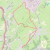
Ottomont - Andrimont - Mont Dison - Thimister - Andrimont - Ottomont
Belgium > Liège > Verviers > Dison > Andrimont
Monter jusqu'à l'église d'Andrimont, rejoindre Mont Dison par un chemin longeant les prairies. Rejoindre Thimister : Les Plenesses. Retour sur Andrimont via un chemin entre les prairies.
Distance: 9.9 Km • Elevation gain: 166 m • Maximum elevation: 295 m