Import a GPX file

Maring trails

Click on a trail to view its statistics, map and profile.
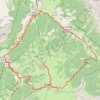
Badia Gravel/Offroad-Radfahren

Italy > Trentino – Alto Adige/Südtirol > South Tyrol > La Ila - Stern - La Villa > Maring

Distance: 29.0 Km • Elevation gain: 1,023 m • Maximum elevation: 2,161 m

Gear up for your next adventure:

🧺Waterproof Dry Sacks - Organize your pack and keep electronics safe from rain and river crossings
🔋Solar Power Banks - Solar chargers for outdoors
🧦Merino Wool Hiking Socks - Moisture-wicking socks to prevent blisters during long topographic surveys
🧭Compass - Navigation compasses for outdoor exploration
📱Tablet Tripod Mounts - Steady platforms for viewing digital maps or taking long exposures

As an Amazon Associate, this site earns from qualifying purchases at no extra cost to you.