Import a GPX file

Chale trails

Click on a trail to view its statistics, map and profile.
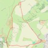
Footpaths and bridleways - St Catherines Down, Isle of Wight

United Kingdom > England > Isle of Wight > Chale > Blackgang

Distance: 5.5 Km • Elevation gain: 184 m • Maximum elevation: 234 m

Other places

Gear up for your next adventure:

🔦Powerful LED Headlamps - Hands-free lighting for night navigation and setting up camp after dark
🥾Hiking Boots - Durable hiking boots for trails and rough terrain
💧Personal Water Filters - Drink safely from streams and lakes identified on your map
🛰️Handheld GPS Units - Rugged GPS devices for tracking coordinates and elevation in the Australian bush
🎨Portable Watercolor Kits - Paint the landscapes and topographic views you discover

As an Amazon Associate, this site earns from qualifying purchases at no extra cost to you.