Import a GPX file

Pratten trails

Click on a trail to view its statistics, map and profile.

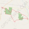
Pratten - Leyburn

Australia > Queensland > Pratten

Talgai State Forest. Leyburn State Forest. #MTB #Loop #Talgai #Leyburn

Distance: 64.6 Km • Elevation gain: 831 m • Maximum elevation: 565 m

Gear up for your next adventure:

📟Satellite Messengers - Two-way satellite communication to stay in touch beyond the cellular grid
🛰️Handheld GPS Units - Rugged GPS devices for tracking coordinates and elevation in the Australian bush
🧊Insulated Cooler Bags - Keep food fresh for day trips to remote geographic sites
📖Australian Bush Survival Books - Local knowledge on finding water and surviving the outback
🪫Rechargeable Headlamps - USB rechargeable headlamps

As an Amazon Associate, this site earns from qualifying purchases at no extra cost to you.