Import a GPX file

Charleston trails

Click on a trail to view its statistics, map and profile.
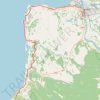
Kawatiri Coastal Trail from Charleston to Westport

New Zealand > West Coast > Buller District > Charleston

Distance: 41.9 Km • Elevation gain: 363 m • Maximum elevation: 53 m

Gear up for your next adventure:

🚁Camera Drones with GPS - Capture aerial views of the landscape to compare with topo maps
📡Weather Radios - Emergency weather radios
🥾Hiking Boots - Durable hiking boots for trails and rough terrain
🎒Tactical Waist Packs - Quick access to your compass, phone, and snacks while walking
👣Snake & Scrub Gaiters - Protection against spinifex, mud, and snakes while walking off-track

As an Amazon Associate, this site earns from qualifying purchases at no extra cost to you.