Import a GPX file

Searcy trails

Click on a trail to view its statistics, map and profile.
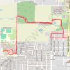
Western Portion of Searcy Bike Trail and Searcy High School

United States > Arkansas > White County > Searcy

Evening Ride

Distance: 6.4 Km • Elevation gain: 42 m • Maximum elevation: 90 m

Gear up for your next adventure:

🧦Merino Wool Hiking Socks - Moisture-wicking socks to prevent blisters during long topographic surveys
🎒Daypacks - Compact backpacks for short hikes
🚁Camera Drones with GPS - Capture aerial views of the landscape to compare with topo maps
👟Lightweight Trail Runners - Agile footwear for fast movement over rugged Australian terrain
🛰️Handheld GPS Units - Rugged GPS devices for tracking coordinates and elevation in the Australian bush

As an Amazon Associate, this site earns from qualifying purchases at no extra cost to you.