Import a GPX file

Area B (Shawnigan Lake) trails

Click on a trail to view its statistics, map and profile.
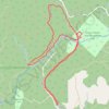
Kinsol Trestle Trail Recreation Site - Kinsol Bypass Trail

Canada > British Columbia > Cowichan Valley Regional District > Area B (Shawnigan Lake)

Vancouver Island. #Hiking #Loop #Kinsol #Vancouver

Distance: 6.2 Km • Elevation gain: 144 m • Maximum elevation: 151 m

Robertson River Falls dual sport ride (not BBF)

Canada > British Columbia > Cowichan Valley Regional District > Area B (Shawnigan Lake)

Full day dual sport loop, from Shawnigan to Robertson River Falls and back. Not BBF due to gates and Hillclimb.

Distance: 204.7 Km • Elevation gain: 5,260 m • Maximum elevation: 785 m

Fun enduro or dual sport tracks in the Oliphant area

Canada > British Columbia > Cowichan Valley Regional District > Area B (Shawnigan Lake)

Distance: 66.4 Km • Elevation gain: 2,391 m • Maximum elevation: 589 m

Solsante trails

Canada > British Columbia > Cowichan Valley Regional District > Area B (Shawnigan Lake)

Distance: 1.6 Km • Elevation gain: 52 m • Maximum elevation: 138 m

Gear up for your next adventure:

🔥Windproof Plasma Lighters - USB rechargeable lighters that work in high-altitude winds
🧊Insulated Cooler Bags - Keep food fresh for day trips to remote geographic sites
🧭Military Style Lensatic Compass - Durable sighting compasses for advanced land navigation and surveying
🎒40L Day Hiking Backpacks - Comfortable packs with hydration support for long days exploring topographic peaks
🗺️Topographic Maps - Detailed maps for hiking and navigation

As an Amazon Associate, this site earns from qualifying purchases at no extra cost to you.