Import a GPX file

Hayfield trails

Click on a trail to view its statistics, map and profile.
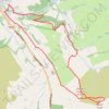
Mount Famine and South Head loop hike from Hayfield

United Kingdom > England > Derbyshire > High Peak > Hayfield

Distance: 9.1 Km • Elevation gain: 416 m • Maximum elevation: 489 m

Gear up for your next adventure:

🥤Hydration Packs - Hydration systems for hiking
Survival Blankets - Emergency thermal blankets
🧼Biodegradable Outdoor Soap - Clean gear and yourself without harming the local ecosystem
🛌Compact Down Sleeping Bags - Warmth without the bulk, ideal for backcountry camping
🔦Powerful LED Headlamps - Hands-free lighting for night navigation and setting up camp after dark

As an Amazon Associate, this site earns from qualifying purchases at no extra cost to you.