Import a GPX file

Danville trails

Click on a trail to view its statistics, map and profile.
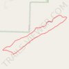
Danville Mountain Trail (Upper Loop, Extended) in Ouachita National Forest

United States > Arkansas > Yell County > Danville

Distance: 4.3 Km • Elevation gain: 146 m • Maximum elevation: 326 m
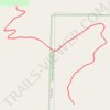
Danville Mountain Trail (Lower Section) in Ouachita National Forest

United States > Arkansas > Yell County > Danville

Distance: 2.1 Km • Elevation gain: 118 m • Maximum elevation: 225 m

Gear up for your next adventure:

🕶️Polarized Outdoor Sunglasses - Reduce glare from rocks and water for better visual navigation
🦟Heavy Duty Insect Repellent - Essential protection against flies, mozzies, and march flies
📍Handheld GPS - GPS devices for hiking and navigation
📖Australian Bush Survival Books - Local knowledge on finding water and surviving the outback
🪢Paracord - Multi-purpose survival cord

As an Amazon Associate, this site earns from qualifying purchases at no extra cost to you.