Import a GPX file

Landimore trails

Click on a trail to view its statistics, map and profile.
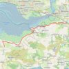
Gower National Landscape Day 5

United Kingdom > Wales > Swansea > Landimore

Distance: 20.7 Km • Elevation gain: 174 m • Maximum elevation: 59 m

Llandimore Marsh

United Kingdom > Wales > Swansea > Landimore

Distance: 12.6 Km • Elevation gain: 221 m • Maximum elevation: 32 m

Gear up for your next adventure:

👖Convertible Hiking Trousers - Zip-off legs to adapt to changing temperatures throughout the day
🎒3L Hydration Reservoirs - Hands-free drinking to stay hydrated on steep contour climbs
🌿Flora and Fauna Field Guides - Identify the plants and animals you encounter on your route
🧥Thermal Emergency Blankets - Compact Mylar blankets to prevent hypothermia if stranded overnight
📸Action Cameras - Record your journey across interesting topographic features in 4K

As an Amazon Associate, this site earns from qualifying purchases at no extra cost to you.