Import a GPX file

Sharp Place trails

Click on a trail to view its statistics, map and profile.
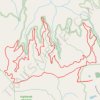
Highlands and Fork Lodge Trail System loop hike

United States > Tennessee > Fentress County > Sharp Place

Distance: 14.1 Km • Elevation gain: 327 m • Maximum elevation: 528 m

Gear up for your next adventure:

🧢Wide Brim Sun Hats - Maximum coverage for the face and neck while out in the open
🧥Thermal Emergency Blankets - Compact Mylar blankets to prevent hypothermia if stranded overnight
🎽Hiking Clothing - Breathable clothing for hiking
🪫Rechargeable Headlamps - USB rechargeable headlamps
👣Snake & Scrub Gaiters - Protection against spinifex, mud, and snakes while walking off-track

As an Amazon Associate, this site earns from qualifying purchases at no extra cost to you.