
Sokobanja Municipality trails
Click on a trail to view its statistics, map and profile.

2018-06-16 14:28:41 Dan
Serbia > Central Serbia > Zajecar Administrative District > Sokobanja Municipality > Resnik
Distance: 3.8 Km • Elevation gain: 1 m • Maximum elevation: 1,167 m
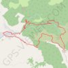
Krstatac: od sela Milušinac, Crnobarski potok, prerast Bogov...
Serbia > Central Serbia > Zajecar Administrative District > Sokobanja Municipality > Milusinac
Distance: 14.2 Km • Elevation gain: 765 m • Maximum elevation: 1,055 m
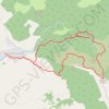
4-45-2 Milusinac-Krstatac-Bogova vrata
Serbia > Central Serbia > Zajecar Administrative District > Sokobanja Municipality > Milusinac
12.99 km
Distance: 13.1 Km • Elevation gain: 693 m • Maximum elevation: 1,055 m