
Crater Lakes via South Boulder Creek trails
Click on a trail to view its statistics, map and profile.
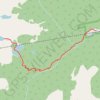
Crater Lakes via South Boulder Creek
United States > Colorado > Gilpin County > East Portal Distributed Camping Area
Starting at the Moffat Tunnel East Portal, the route enters Roosevelt National Forest and follows the South Boulder Creek Trail into the James Peak Wilderness, passing dense subalpine forest, creekside clearings, and the Forest Lakes Trail junction before turning onto the signed Crater Lakes Trail. The climb…
Distance: 11.0 Km • Elevation gain: 559 m • Maximum elevation: 3,364 m