
Evening Run trails
Click on a trail to view its statistics, map and profile.

Virginia Evening Run
Distance: 17.1 Km • Elevation gain: 135 m • Maximum elevation: 117 m

Old Mill Pond Trail loop
United States > South Carolina > Lexington County > Lexington
Evening Run
Distance: 5.7 Km • Elevation gain: 63 m • Maximum elevation: 96 m
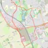
Isham Footpath
United Kingdom > England > North Northamptonshire > Kettering
Evening Run
Distance: 10.2 Km • Elevation gain: 111 m • Maximum elevation: 86 m

Evening Run
Belgium > East Flanders > Oudenaarde > Zwalm > Sint-Denijs-Boekel
Distance: 5.1 Km • Elevation gain: 20 m • Maximum elevation: 36 m