Import a GPX file

Pomona Loop trails

Click on a trail to view its statistics, map and profile.
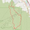
Bane Canyon Loop

United States > California > San Bernardino County > Chino Hills

Beginning near the North Entrance off Sapphire Road, the loop briefly follows Bane Canyon Road into Chino Hills State Park before leaving the paved corridor for the East Fence Line Trail, where rolling grasslands, coastal sage scrub, spring wildflowers, and views across Bane Canyon and the nearby urban edge…

Distance: 12.2 Km • Elevation gain: 435 m • Maximum elevation: 357 m
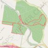
Yurol State Forest Loop

Australia > Queensland

Loop hike / run in the Yurol State Forest. #Hiking #Running #Loop #Forest #Nature

Distance: 12.8 Km • Elevation gain: 144 m • Maximum elevation: 128 m

Pomona Loop

Australia > Queensland > Pomona

#MTB #Loop

Distance: 38.2 Km • Elevation gain: 596 m • Maximum elevation: 214 m

Pomona Loop

Australia > Queensland > Pomona

#MTB #Loop

Distance: 63.6 Km • Elevation gain: 1,365 m • Maximum elevation: 460 m

Gear up for your next adventure:

🧦Hiking Socks - Comfortable socks for long hikes
🔪Outdoor Multi-tools - Versatile tools for gear repair and survival tasks in the wilderness
🔋Rechargeable Batteries - Eco-friendly power for high-drain GPS units and flashlights
🦯Trekking Poles - Walking poles for hiking stability
🍳Ultralight Camping Stoves - Boil water quickly for meals using minimal fuel

As an Amazon Associate, this site earns from qualifying purchases at no extra cost to you.