
Monday Morning Hiking trails
Click on a trail to view its statistics, map and profile.

Half Dome via Vernal and Nevada Falls
United States > California > Mariposa County > Curry Village
Starting near Happy Isles in eastern Yosemite Valley, this route follows the Merced River into the Mist Trail corridor, with early granite scenery and possible views toward Illilouette Fall before reaching the Vernal Fall Footbridge. The ascent then climbs beside Vernal Fall to Emerald Pool and Silver Apron,…
Distance: 26.7 Km • Elevation gain: 2,054 m • Maximum elevation: 2,693 m

Half Dome via John Muir Trail and Vernal Fall in Yosemite National Park
United States > California > Mariposa County > Curry Village
The Half Dome hike is a true Yosemite adventure. With breathtaking views of the falls, Yosemite Valley, and the Sierra Nevada, it rewards those who tackle its challenging terrain. The final ascent up the cable route is thrilling, and while demanding, it’s an unforgettable experience that’s well worth the…
Distance: 26.3 Km • Elevation gain: 1,941 m • Maximum elevation: 2,687 m
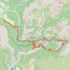
Vernal Fall, Nevada Fall and Clark Point loop via John Muir Trail and Mist Trail
United States > California > Mariposa County > Curry Village
The Vernal Fall and Nevada Fall loop hike is a fantastic adventure through Yosemite, offering some of the park's most iconic waterfall views. You'll tackle steep inclines, including the famous "Nature's Giant Staircase" with over 600 steps, but the effort is rewarded with breathtaking panoramas of cascading…
Distance: 13.1 Km • Elevation gain: 971 m • Maximum elevation: 1,847 m

Nevada Fall Loop
United States > California > Mariposa County > Curry Village
Loop hike from Curry Village to Nevada Fall via Happy Isles Bridge, Merced River, John Muir Trail, Mist Trail, Vernal Fall and Clark Point in the Yosemite National Park. #Hiking #Loop #Mountain #River #Falls #Nature #Forest #Park #Yosemite
Distance: 14.3 Km • Elevation gain: 1,153 m • Maximum elevation: 1,849 m
