Import a GPX file

Day 1 Hendaye to St Jean Pied de Port trails

Click on a trail to view its statistics, map and profile.
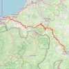
Day 1 - Hendaye to St. Jean Pied de Port

France > Nouvelle-Aquitaine > Pyrénées-Atlantiques > Hendaye

Distance: 77.1 Km • Elevation gain: 2,065 m • Maximum elevation: 373 m

Gear up for your next adventure:

🧥Down Jackets - Insulated jackets for cold weather
🔋Solar Power Banks - Charge your phone and GPS using the sun while deep in the bush
🧭Global Orienteering Compass - High-precision liquid-filled compasses for accurate map reading and navigation
🕯️Emergency Whistles - Safety whistles for hiking
🚴Cycling Backpacks - Backpacks for cyclists

As an Amazon Associate, this site earns from qualifying purchases at no extra cost to you.