Import a GPX file

Arizona Cypress Trail Anaconda Trail and Snake Trail Loop trails

Click on a trail to view its statistics, map and profile.
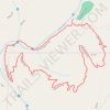
Arizona Cypress Trail, Anaconda Trail and Snake Trail Loop

United States > Arizona > Yavapai County

Distance: 5.0 Km • Elevation gain: 99 m • Maximum elevation: 1,430 m

Gear up for your next adventure:

🎒3L Hydration Reservoirs - Hands-free drinking to stay hydrated on steep contour climbs
🎨Portable Watercolor Kits - Paint the landscapes and topographic views you discover
💡Collapsible Camping Lanterns - Illuminate your base camp or tent for map studying at night
📷Backpack Camera Clips - Quick access to your camera while keeping your hands free for climbing
🚁Camera Drones with GPS - Capture aerial views of the landscape to compare with topo maps

As an Amazon Associate, this site earns from qualifying purchases at no extra cost to you.