Import a GPX file

Alpine National Park Butcher Country Track trails

Click on a trail to view its statistics, map and profile.

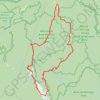
Alpine National Park - Butcher Country Track

Australia > Victoria > Licola

#Bike #Loop #Alpine

Distance: 155.6 Km • Elevation gain: 4,490 m • Maximum elevation: 1,635 m

Gear up for your next adventure:

🗺️Topographic Maps - Detailed maps for hiking and navigation
🛰️Handheld GPS Units - Rugged GPS devices for tracking coordinates and elevation in the Australian bush
🔋Solar Power Banks - Solar chargers for outdoors
🧤Thermal Hiking Gloves - Keep your hands warm and functional during high-altitude winter treks
🔥Ferrocerium Rod Fire Starters - Reliable fire lighting in wet or windy conditions without matches

As an Amazon Associate, this site earns from qualifying purchases at no extra cost to you.