Import a GPX file

Mostuéjouls trails

Click on a trail to view its statistics, map and profile.
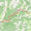
Chemin de Saint-Guilhem-le-Désert - jour 8/14 - du Rozier à ...

France > Occitania > Aveyron > Mostuéjouls > La Muse

Distance: 19.6 Km • Elevation gain: 1,416 m • Maximum elevation: 971 m

Other places

Gear up for your next adventure:

🧼Clip-on Hand Sanitizer - Maintain hygiene when water for washing is scarce
🏃Compression Recovery Socks - Reduce leg fatigue after heavy days of elevation gain
⛺Ultralight Solo Tents - Compact shelters for multi-day topographic surveying expeditions
👣Snake & Scrub Gaiters - Protection against spinifex, mud, and snakes while walking off-track
📡Portable Emergency Radios - Stay informed about weather warnings and bushfire alerts

As an Amazon Associate, this site earns from qualifying purchases at no extra cost to you.